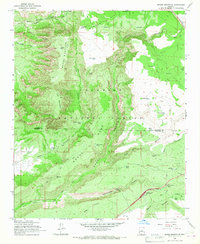
1965 Map of Munds Mountain
USGS Topo · Published 1967About this map
Schnebly Hill Road snakes across the high desert terrain of the Coconino National Forest, climbing past the landmark Merry-Go-Round rock formation toward the high ridges of Munds Mountain. This 1960s survey documents a landscape defined by seasonal water management, illustrated by a dense network of catchment tanks like Committee Tank, Dutchs Tank, and Jacks Canyon Tank that supported livestock and wildlife across Horse Mesa. To the east, Woods Ranch stands as a rare named settlement point in a region of deep drainages such as Bear Wallow Canyon and Rattlesnake Canyon. The map records early modern infrastructure at the Stoneman Lake Interchange, where the developing highway system meets traditional routes like the Pack Trail and the winding course of Dry Beaver Creek.
Find a feature on this map
57 named features on this map. Tap any name to fly to it.
Don’t see what you’re looking for? This feature index may not catch every label — zoom into the map to look around manually.
Map Details
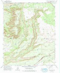
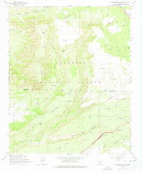
Editions of this 1965 Munds Mountain Map
3 editions found
Other maps of this area

1887 · Verde
USGS Topo · 1:250,000

1892 · Verde
USGS Topo · 1:250,000

1923 · Camp Verde
USGS Topo · 1:125,000

1932 · Camp Verde
USGS Topo · 1:125,000

1936 · Camp Verde
USGS Topo · 1:125,000

1954 · Holbrook
USGS Topo · 1:250,000

1957 · Holbrook
USGS Topo · 1:250,000

1958 · Holbrook
USGS Topo · 1:250,000

1960 · Holbrook
USGS Topo · 1:250,000
1965 · Mormon Mountain
USGS Topo · 1:24,000