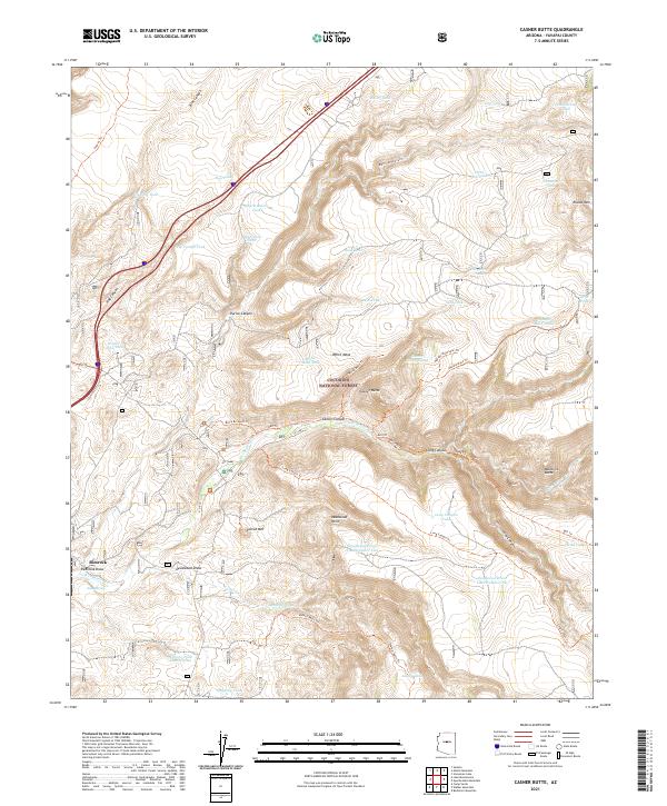
2021 Map of Casner Butte
USGS Topo · Published 2021About this map
Coconino National Forest dominates this landscape, where high plateaus and deep drainages define the ranching and recreational history of the region. Near the settlement of Rimrock, the terrain transitions into a complex network of canyons and mesas, including the prominent White Mesa and Casner Butte. This 2021 study documents a critical water-management system essential for both livestock and wildlife in a semi-arid environment, evidenced by dozens of named catchments such as Watermelon Tank, Pig Trough Tank, and Three-Jim-Tank. The area's hydrology is further anchored by Soda Spring and Lander Spring, which feed into the Wet Beaver Cr and Walker Cr systems. Historic movement through the land is traced via an extensive trail network, including the Bruce Brockett Trl and the Walker Basin Trl, which navigate through geological landmarks like Sacred Mtn and Maverick Butte.
Find a feature on this map
62 named features on this map. Tap any name to fly to it.
Don’t see what you’re looking for? This feature index may not catch every label — zoom into the map to look around manually.
Map Details
Editions of this 2021 Casner Butte Map
This is the sole edition of this map. No revisions or reprints were ever made.
Other maps of this area

1887 · Verde
USGS Topo · 1:250,000

1892 · Verde
USGS Topo · 1:250,000

1923 · Camp Verde
USGS Topo · 1:125,000

1932 · Camp Verde
USGS Topo · 1:125,000

1936 · Camp Verde
USGS Topo · 1:125,000

1954 · Holbrook
USGS Topo · 1:250,000

1957 · Holbrook
USGS Topo · 1:250,000

1958 · Holbrook
USGS Topo · 1:250,000

1960 · Holbrook
USGS Topo · 1:250,000
1965 · Munds Mountain
USGS Topo · 1:24,000