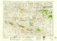
1958 Map of Casper
USGS Topo · Published 1958About this map
The North Platte River anchors this mid-century survey of central Wyoming, winding through a complex landscape of energy production and water management. Highlighting the era's industrial footprint, the map documents the Poison Spider Oil Field and Grieve Oil Field, while the historic route of the Oregon Trail is traced across the high plains. Major infrastructure projects like the Pathfinder Dam and Alcova Dam have transformed the river valley into large reservoirs, contrasting with the wilderness of the Medicine Bow National Forest and the heights of Casper Mountain. Settlements such as Mills, Evansville, and the remote oil town of Bairoil illustrate the region's mid-century growth. The map also captures the sprawling drainage of the Great Divide Basin and the Shirley Basin, showing a network of ranching roads, rail lines like the Chicago and North Western, and aviation facilities at the Natrona County Airport.
Find a feature on this map
110 named features on this map. Tap any name to fly to it.
Don’t see what you’re looking for? This feature index may not catch every label — zoom into the map to look around manually.
Map Details
Editions of this 1958 Casper Map
2 editions found

Other maps of this area

1893 · Fort Steele
USGS Topo · 1:125,000

1914 · Hanna
USGS Topo · 1:62,500

1914 · Walcott
USGS Topo · 1:62,500

1914 · Saddleback Hills
USGS Topo · 1:62,500

1915 · Como Ridge
USGS Topo · 1:48,000

1918 · Como Ridge
USGS Topo · 1:62,500

1921 · Saddleback Hills
USGS Topo · 1:62,500

1949 · Brookhurst
USGS Topo · 1:24,000

1949 · Campbell Hill
USGS Topo · 1:24,000

1949 · Parkerton
USGS Topo · 1:24,000