
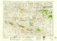
1958 Map of Casper
USGS Topo · Published 1958About this map
The North Platte River serves as the industrial and geographical backbone of this Central Wyoming region during the late 1950s. The city of Casper and its neighbor Evansville appear at a height of mid-century development, supported by the Chicago and North Western Railway and the Chicago, Burlington and Quincy Railroad. The map reveals an economy deeply tied to natural resources, shown through the extensive Poison Spider Oil Field and the noted Oil Mountain Oil Field (abandoned).
Find a feature on this map
97 named features on this map. Tap any name to fly to it.
Don’t see what you’re looking for? This feature index may not catch every label — zoom into the map to look around manually.
Map Details
Editions of this 1958 Casper Map
2 editions found
Other maps of this area

1893 · Fort Steele
USGS Topo · 1:125,000

1914 · Hanna
USGS Topo · 1:62,500

1914 · Walcott
USGS Topo · 1:62,500

1914 · Saddleback Hills
USGS Topo · 1:62,500

1915 · Como Ridge
USGS Topo · 1:48,000

1918 · Como Ridge
USGS Topo · 1:62,500

1921 · Saddleback Hills
USGS Topo · 1:62,500

1949 · Brookhurst
USGS Topo · 1:24,000

1949 · Campbell Hill
USGS Topo · 1:24,000

1949 · Parkerton
USGS Topo · 1:24,000