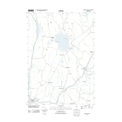
2012 Map of Caspian Lake
USGS Topo · Published 2012About this map
Hardwick and Greensboro define the settlement pattern of this northern Vermont landscape, where the Lamoille River and its tributaries carve through the upland terrain. The map captures a high density of small historic communities and family-named landmarks, ranging from Campbells Corner to Dows Crossing. For genealogists and local researchers, the map is remarkably dense with burial sites such as Maple Street Cem, Saint Michaels Cem, and Norris Cem, alongside civic anchors like the Greensboro Depot. The prominence of Caspian Lake and Lake Elligo suggests a region where water resources and early transportation corridors dictated the growth of centers like Hardwick Center and East Hardwick. Significant landmarks such as Camp Ethan Allen and the historic route along Hardwick Street provide a clear view of the area's developed footprint in the early 21st century.
Find a feature on this map
144 named features on this map. Tap any name to fly to it.
Don’t see what you’re looking for? This feature index may not catch every label — zoom into the map to look around manually.
Map Details
Editions of this 2012 Caspian Lake Map
This is the sole edition of this map. No revisions or reprints were ever made.
Other maps of this area

1928 · Hardwick
USGS Topo · 1:62,500

1934 · Hardwick
USGS Topo · 1:48,000

1935 · Lyndonville
USGS Topo · 1:48,000

1938 · Hardwick
USGS Topo · 1:62,500

1938 · St. Johnsbury
USGS Topo · 1:48,000

1939 · Lyndonville
USGS Topo · 1:62,500

1939 · Plainfield
USGS Topo · 1:48,000

1940 · Plainfield
USGS Topo · 1:62,500

1943 · Plainfield
USGS Topo · 1:62,500

1943 · St. Johnsbury
USGS Topo · 1:62,500