
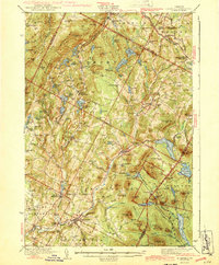
1943 Map of Plainfield
USGS Topo · Published 1943About this map
The Winooski River carves through this central Vermont landscape during the early 1940s, connecting the industrial and transport hubs of Plainfield and Marshfield. This era is defined by a dense network of small rural schoolhouses and family-named pits, such as the Shadow Pit and Smith Pit, which dot the hillsides around Woodbury and Cabot. The presence of the St Johnsbury and Lake Champlain RR and the Montpelier and Wells River RR underscores the importance of rail in moving timber and local resources from the surrounding uplands.
Find a feature on this map
126 named features on this map. Tap any name to fly to it.
Don’t see what you’re looking for? This feature index may not catch every label — zoom into the map to look around manually.
Map Details
Editions of this 1943 Plainfield Map
2 editions found
Other maps of this area

1919 · Montpelier
USGS Topo · 1:62,500

1921 · Montpelier
USGS Topo · 1:62,500

1922 · Barre
USGS Topo · 1:48,000

1924 · Barre
USGS Topo · 1:62,500

1927 · Hyde Park
USGS Topo · 1:48,000

1928 · Hardwick
USGS Topo · 1:62,500

1930 · Hyde Park
USGS Topo · 1:62,500

1931 · Woodsville
USGS Topo · 1:48,000

1934 · Hardwick
USGS Topo · 1:48,000

1935 · Woodsville
USGS Topo · 1:62,500