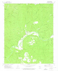
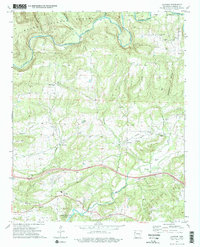
1973 Map of Cass
USGS Topo · Published 1976About this map
The Mulberry River winds through the heart of the Ozark National Forest in this early 1970s topographical record. The settlement of Cass serves as a central point in this mountain landscape, situated near where the river creates a dramatic southward curve at Turners Bend. The area's topography is defined by significant elevations including Fly Gap Mtn, Hare Mtn, and Whiting Mountain, with numerous hollows like Spy Rock Hollow and Eureka Springs Hollow carving through the terrain.
Find a feature on this map
55 named features on this map. Tap any name to fly to it.
Don’t see what you’re looking for? This feature index may not catch every label — zoom into the map to look around manually.
Map Details
Editions of this 1973 Cass Map
3 editions found
Other maps of this area

1879 · Cravens
USGS Topo · 1:62,500

1887 · Watalula
USGS Topo · 1:62,500

1906 · Batson
USGS Topo · 1:62,500

1939 · Watalula
USGS Topo · 1:62,500

1943 · St. Paul
USGS Topo · 1:62,500

1946 · St. Paul
USGS Topo · 1:62,500

1956 · Russellville
USGS Topo · 1:250,000
1963 · Hunt
USGS Topo · 1:24,000

1964 · Russellville
USGS Topo · 1:250,000
1973 · Cravens
USGS Topo · 1:24,000