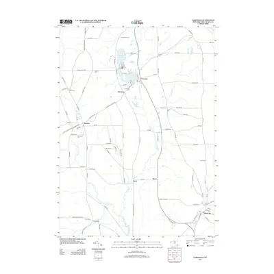
2013 Map of Cassadaga
USGS Topo · Published 2013About this map
Lily Dale sits at the northern edge of this New York landscape, a unique community adjacent to the waters of the Cassadaga Lakes. This area of Chautauqua County is defined by its small crossroads settlements and a network of water bodies, including Mud Lake and the winding Cassadaga Cr. To the south, Sinclairville serves as a significant hub, where Mill Cr meets the local street grid. The map reveals a pattern of rural life organized around water and road junctions, with several named hamlets such as Stockton, Kabob, and Moons scattered throughout the territory.
Find a feature on this map
102 named features on this map. Tap any name to fly to it.
Don’t see what you’re looking for? This feature index may not catch every label — zoom into the map to look around manually.
Map Details
Editions of this 2013 Cassadaga Map
This is the sole edition of this map. No revisions or reprints were ever made.
Other maps of this area

1900 · Dunkirk
USGS Topo · 1:62,500

1900 · Cherry Creek
USGS Topo · 1:62,500

1904 · Chautaqua
USGS Topo · 1:62,500

1905 · Jamestown
USGS Topo · 1:62,500

1941 · Cherry Creek
USGS Topo · 1:62,500

1941 · Chautauqua
USGS Topo · 1:62,500

1942 · Jamestown
USGS Topo · 1:62,500

1943 · Dunkirk
USGS Topo · 1:62,500

1954 · Chautauqua
USGS Topo · 1:24,000

1954 · Ellery Center
USGS Topo · 1:24,000