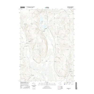
2016 Map of Cassadaga
USGS Topo · Published 2016About this map
Cassadaga Lakes and the surrounding wetland corridor of Cassadaga Cr anchor this portion of Chautauqua County. The terrain is defined by glacial legacy, where the Bear Lake Outlet and Mud Lake feed into a complex system of brooks and creeks that shaped the early settlement patterns of the region. Distinct village centers like Cassadaga and Sinclairville are prominent, connected by a network of county roads and historic thoroughfares such as County Touring Route 380. For genealogists, the map is particularly dense with burial grounds, including the Christian Cem and Bachelor Cem, alongside several family-named landmarks like Pickett Brook and Nelson Hill Road. The proximity of the small hamlets of Kabob, Moons, and Burnhams illustrates the historical density of these rural dairy and agricultural communities before the consolidation of the modern era.
Find a feature on this map
80 named features on this map. Tap any name to fly to it.
Don’t see what you’re looking for? This feature index may not catch every label — zoom into the map to look around manually.
Map Details
Editions of this 2016 Cassadaga Map
This is the sole edition of this map. No revisions or reprints were ever made.
Other maps of this area

1900 · Dunkirk
USGS Topo · 1:62,500

1900 · Cherry Creek
USGS Topo · 1:62,500

1904 · Chautaqua
USGS Topo · 1:62,500

1905 · Jamestown
USGS Topo · 1:62,500

1941 · Cherry Creek
USGS Topo · 1:62,500

1941 · Chautauqua
USGS Topo · 1:62,500

1942 · Jamestown
USGS Topo · 1:62,500

1943 · Dunkirk
USGS Topo · 1:62,500

1954 · Chautauqua
USGS Topo · 1:24,000

1954 · Ellery Center
USGS Topo · 1:24,000