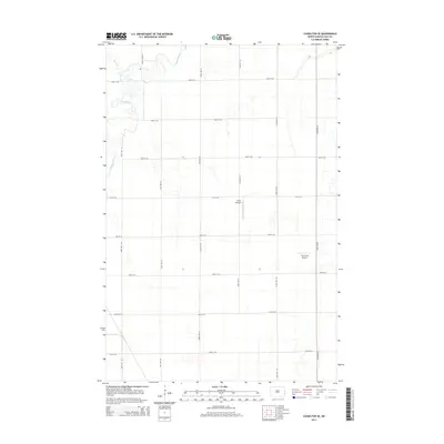
2014 Map of Casselton SE
USGS Topo · Published 2014About this map
The Maple River meanders through this agricultural landscape in Cass County, defining the drainage patterns of the Red River Valley. This section of Durbin Township is characterized by a precise grid of rural section roads, including 38th St SE and 160 1/2 Ave SE, that delineate the fertile plains. Aviation infrastructure stands out against the agricultural backdrop, with both Kraft Airport and True North Airpark serving the local farming community. Along the northwestern edge, the confluence of Swan Cr with the river highlights the subtle hydrological features of this prairie terrain. The map captures a moment in the modern era where traditional section-line farming practices intersect with private aviation interests, providing a clear look at land use in the southeastern vicinity of Casselton.
Find a feature on this map
19 named features on this map. Tap any name to fly to it.
Don’t see what you’re looking for? This feature index may not catch every label — zoom into the map to look around manually.
Map Details
Editions of this 2014 Casselton SE Map
This is the sole edition of this map. No revisions or reprints were ever made.
Other maps of this area

1895 · Fargo
USGS Topo · 1:125,000

1895 · Casselton
USGS Topo · 1:125,000

1897 · Fargo
USGS Topo · 1:125,000

1897 · Casselton
USGS Topo · 1:125,000

1953 · Fargo
USGS Topo · 1:250,000

1956 · Fargo
USGS Topo · 1:250,000

1959 · Kindred
USGS Topo · 1:24,000

1959 · Leonard
USGS Topo · 1:24,000

1959 · South West Fargo
USGS Topo · 1:24,000

1959 · West Fargo
USGS Topo · 1:24,000