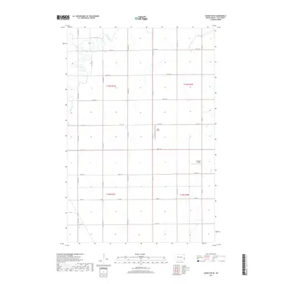
2017 Map of Casselton SE
USGS Topo · Published 2017About this map
The Maple River meanders across the northwestern corner of this Cass County landscape, its winding channel creating a riparian break in the surrounding grid of agricultural sections. In the southeastern reaches of T139N R51W and T139N R50W, the terrain is remarkably flat, a characteristic of the Red River Valley that facilitates the placement of private aviation facilities. Kraft Airport and True North Airpark are positioned within this section-line framework, serving as local landmarks for the farming communities near the river. The map details the precise township and range boundaries including t139n r51w and t138n r50w, while highlighting the secondary drainage of Swan Cr near the northern boundary. Roads such as Co Rd 6 and Co Rd 15 follow the strictly surveyed section lines, providing the primary infrastructure for this rural region during the mid-2010s.
Find a feature on this map
24 named features on this map. Tap any name to fly to it.
Don’t see what you’re looking for? This feature index may not catch every label — zoom into the map to look around manually.
Map Details
Editions of this 2017 Casselton SE Map
This is the sole edition of this map. No revisions or reprints were ever made.
Other maps of this area

1895 · Fargo
USGS Topo · 1:125,000

1895 · Casselton
USGS Topo · 1:125,000

1897 · Fargo
USGS Topo · 1:125,000

1897 · Casselton
USGS Topo · 1:125,000

1953 · Fargo
USGS Topo · 1:250,000

1956 · Fargo
USGS Topo · 1:250,000

1959 · Kindred
USGS Topo · 1:24,000

1959 · Leonard
USGS Topo · 1:24,000

1959 · South West Fargo
USGS Topo · 1:24,000

1959 · West Fargo
USGS Topo · 1:24,000