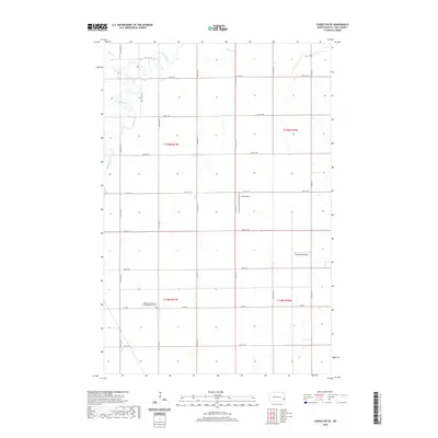
2020 Map of Casselton SE
USGS Topo · Published 2020About this map
The Maple River meanders through the northwest corner of this Cass County landscape, its winding course contrasting with the strict section-line grid of the Red River Valley. This agricultural region is defined by a dense network of local roads such as 160th Ave SE and 38th St SE, supporting the surrounding farmsteads. A significant local landmark is the Addison Evangelical Congregational Cem, situated near the intersection of Co Rd 6 and 161st Ave SE, which serves as a vital touchstone for genealogical research in the area. The presence of Kraft Airport and True North Airpark highlights the importance of aerial access in this expansive prairie environment, where large-scale farming operations and small rural communities rely on established transport corridors like Co Rd 15 to connect with the larger region.
Find a feature on this map
26 named features on this map. Tap any name to fly to it.
Don’t see what you’re looking for? This feature index may not catch every label — zoom into the map to look around manually.
Map Details
Editions of this 2020 Casselton SE Map
This is the sole edition of this map. No revisions or reprints were ever made.
Other maps of this area

1895 · Fargo
USGS Topo · 1:125,000

1895 · Casselton
USGS Topo · 1:125,000

1897 · Fargo
USGS Topo · 1:125,000

1897 · Casselton
USGS Topo · 1:125,000

1953 · Fargo
USGS Topo · 1:250,000

1956 · Fargo
USGS Topo · 1:250,000

1959 · Kindred
USGS Topo · 1:24,000

1959 · Leonard
USGS Topo · 1:24,000

1959 · South West Fargo
USGS Topo · 1:24,000

1959 · West Fargo
USGS Topo · 1:24,000