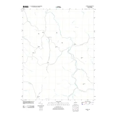
2010 Map of Cassity
USGS Topo · Published 2010About this map
The Middle Fork River winds through this West Virginia landscape, anchoring a series of small mountain communities and rural outposts. The map documents the layout of the Cassity Community, including the primary settlement at Cassity, and the nearby locales of Loda and Cubana. This area is defined by its deep drainages and high points like Kelly Knob and Bear Knob, where the local road network often follows the natural courses of waterways such as Cassity Fork and Panther Run.
Find a feature on this map
46 named features on this map. Tap any name to fly to it.
Don’t see what you’re looking for? This feature index may not catch every label — zoom into the map to look around manually.
Map Details
Editions of this 2010 Cassity Map
This is the sole edition of this map. No revisions or reprints were ever made.
Other maps of this area

1889 · Beverly
USGS Topo · 1:125,000

1892 · Beverly
USGS Topo · 1:125,000

1893 · Buckhannon
USGS Topo · 1:125,000

1896 · Buckhannon
USGS Topo · 1:125,000

1897 · Buckhannon
USGS Topo · 1:125,000

1909 · Elkins
USGS Topo · 1:62,500

1912 · Sago
USGS Topo · 1:48,000

1913 · Pickens
USGS Topo · 1:48,000

1914 · Sago
USGS Topo · 1:62,500

1915 · Pickens
USGS Topo · 1:62,500