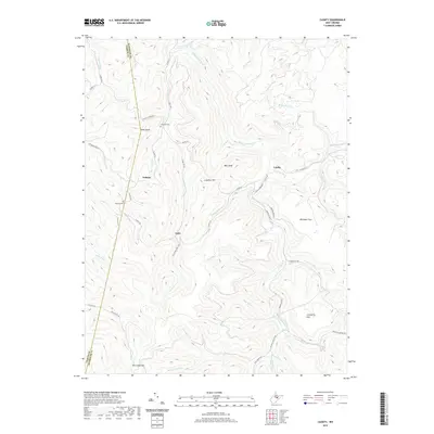
2019 Map of Cassity
USGS Topo · Published 2019About this map
The Middle Fork River carves through this upland portion of the Allegheny Mountains, where the small settlements of Cassity and Cubana serve as primary points of interest. These mountain communities are defined by their proximity to various watercourses, including Cassity Fork and the Mulberry Fork. The landscape is a complex network of ridges and hollows, marked by high points such as Kelly Knob and Bear Knob. Local history is preserved in small burial grounds like Long Run Cem and Simmons Cem, while the southern reaches of the map reveal broader terrain features like Whitman Flats and Cranberry Flat. The boundary between Upshur and Randolph counties runs along the western portion of the sheet, crossing the Old Adolph Rd near See Camp Gap. This survey documents a rural environment where development is concentrated along the narrow river valleys and the winding mountain roads that connect these remote locales.
Find a feature on this map
54 named features on this map. Tap any name to fly to it.
Don’t see what you’re looking for? This feature index may not catch every label — zoom into the map to look around manually.
Map Details
Editions of this 2019 Cassity Map
This is the sole edition of this map. No revisions or reprints were ever made.
Other maps of this area

1889 · Beverly
USGS Topo · 1:125,000

1892 · Beverly
USGS Topo · 1:125,000

1893 · Buckhannon
USGS Topo · 1:125,000

1896 · Buckhannon
USGS Topo · 1:125,000

1897 · Buckhannon
USGS Topo · 1:125,000

1909 · Elkins
USGS Topo · 1:62,500

1912 · Sago
USGS Topo · 1:48,000

1913 · Pickens
USGS Topo · 1:48,000

1914 · Sago
USGS Topo · 1:62,500

1915 · Pickens
USGS Topo · 1:62,500