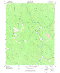
1977 Map of Cassity
USGS Topo · Published 1977About this map
The Middle Fork River carves a deep valley through this portion of Randolph County, serving as the primary geographic corridor for the settlement at Cassity. During the late 1970s, the landscape was defined by a mix of traditional Appalachian small-holdings and industrial resource extraction. Evidence of the region's energy economy is pervasive, with numerous Gas Wells and Strip Mines dotting the ridges above Roaring Creek and Whitman Flats. A notable Mine Dump near the river reflects the intensity of local coal operations. For genealogists, the map preserves the location of Long Run (Site) and Cubana, alongside the Simmons Cem and several unnamed burial grounds. The rugged terrain rises toward Bear Knob and See Camp Gap, where a network of Jeep Trails provides the only access into the densely wooded hinterlands of the Upshur and Randolph county line.
Find a feature on this map
38 named features on this map. Tap any name to fly to it.
Don’t see what you’re looking for? This feature index may not catch every label — zoom into the map to look around manually.
Map Details
Editions of this 1977 Cassity Map
This is the sole edition of this map. No revisions or reprints were ever made.
Other maps of this area

1889 · Beverly
USGS Topo · 1:125,000

1892 · Beverly
USGS Topo · 1:125,000

1893 · Buckhannon
USGS Topo · 1:125,000

1896 · Buckhannon
USGS Topo · 1:125,000

1897 · Buckhannon
USGS Topo · 1:125,000

1909 · Elkins
USGS Topo · 1:62,500

1912 · Sago
USGS Topo · 1:48,000

1913 · Pickens
USGS Topo · 1:48,000

1914 · Sago
USGS Topo · 1:62,500

1915 · Pickens
USGS Topo · 1:62,500