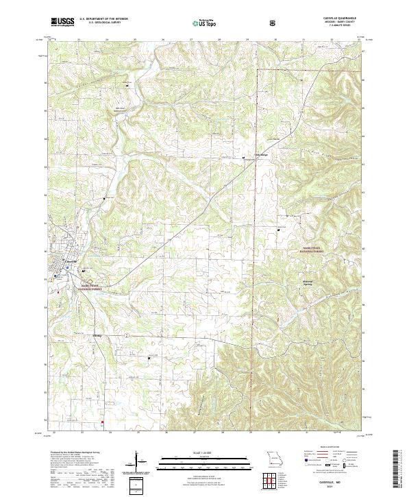
2021 Map of Cassville
USGS Topo · Published 2021About this map
Cassville serves as the focal point of this southwestern Missouri landscape, where the Barry County Judicial Center marks the local seat of government. The area is defined by its numerous family and community burial grounds, including Oak Hill Cem and the Quaker Cem, which offer significant value for genealogical research in Barry County. Beyond the town limits, the terrain transitions into the protected woodlots of the Mark Twain National Forest, characterized by deep drainages such as Corder Hollow and Roaring River Hollow. Geologic features like the Ash Cave Natural Arch and the karst topography of Sink Hole Ridge illustrate the region's complex hydrology, which is further evidenced by a high density of named springs, including Twin Springs and Mineral Spring. This network of water sources historically dictated the location of rural settlements like Hilltop and the surrounding agricultural homesteads.
Find a feature on this map
96 named features on this map. Tap any name to fly to it.
Don’t see what you’re looking for? This feature index may not catch every label — zoom into the map to look around manually.
Map Details
Editions of this 2021 Cassville Map
This is the sole edition of this map. No revisions or reprints were ever made.
Other maps of this area

1927 · Shell Knob
USGS Topo · 1:62,500

1937 · Cassville
USGS Topo · 1:48,000

1942 · Aurora
USGS Topo · 1:62,500

1943 · Monett
USGS Topo · 1:62,500

1944 · Cassville
USGS Topo · 1:62,500

1945 · Harrison
USGS Topo · 1:250,000

1945 · Aurora
USGS Topo · 1:62,500

1949 · Harrison
USGS Topo · 1:250,000

1950 · Shell Knob
USGS Topo · 1:62,500

1954 · Harrison
USGS Topo · 1:250,000