
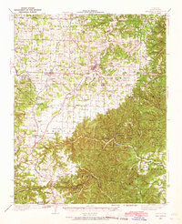
1937 Map of Cassville
USGS Topo · Published 1937About this map
Cassville and the surrounding Barry County landscape appear in this 1937 survey as a hub of rural education and Ozark recreation. The southern portion of the map is dominated by the steep drainages of Roaring River, where the Roaring River State Park and a C C C Camp reflect New Deal-era conservation efforts and the development of public lands. A dense network of small schoolhouses, including Washburn Prairie Sch and Quaker Sch, points to a highly localized settlement pattern where distance to the nearest classroom was a primary concern for farming families.
Find a feature on this map
75 named features on this map. Tap any name to fly to it.
Don’t see what you’re looking for? This feature index may not catch every label — zoom into the map to look around manually.
Map Details
Editions of this 1937 Cassville Map
2 editions found
Other maps of this area

1899 · Fayetteville
USGS Topo · 1:125,000

1900 · Eureka Springs
USGS Topo · 1:125,000

1901 · Eureka Springs
USGS Topo · 1:125,000

1901 · Fayetteville
USGS Topo · 1:125,000

1904 · Fayetteville
USGS Topo · 1:125,000

1927 · Shell Knob
USGS Topo · 1:62,500

1941 · Rocky Comfort
USGS Topo · 1:62,500

1942 · Aurora
USGS Topo · 1:62,500

1943 · Ritchey
USGS Topo · 1:62,500

1943 · Monett
USGS Topo · 1:62,500