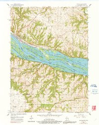
1955 Map of Cassville
USGS Topo · Published 1991About this map
The Mississippi River dominates this mid-century landscape, carving a complex network of islands and backwaters such as Sweezy Island, Jack Oak Island, and Bertom Lake. Along the Wisconsin shore, the village of Cassville is a focal point of industrial activity, marked by a prominent Powerplant and a Landing Field positioned near the Chicago Burlington and Quincy railroad. The map reveals the shifting nature of rural life in the driftless region, noting several decommissioned landmarks like Waupeton Sch and Buena Vista Sch. Across the river in Iowa, the community of North Buena Vista sits at the base of the bluffs, where the Chicago Milwaukee St Paul and Pacific tracks follow the narrow terrace between the water and the rising terrain of Panther Hollow.
Find a feature on this map
65 named features on this map. Tap any name to fly to it.
Don’t see what you’re looking for? This feature index may not catch every label — zoom into the map to look around manually.
Map Details
Editions of this 1955 Cassville Map
2 editions found
Other maps of this area

1900 · Lancaster
USGS Topo · 1:125,000

1902 · Elkader
USGS Topo · 1:125,000

1904 · Lancaster
USGS Topo · 1:125,000

1908 · Lancaster
USGS Topo · 1:125,000

1955 · Cassville
USGS Topo · 1:24,000

1955 · Balltown
USGS Topo · 1:24,000

1956 · Sherrill
USGS Topo · 1:24,000

1957 · Turkey River
USGS Topo · 1:24,000

1957 · Holy Cross
USGS Topo · 1:24,000

1959 · Dubuque
USGS Topo · 1:250,000