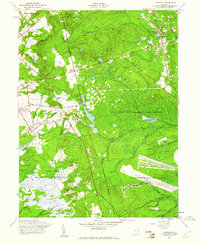
1957 Map of Cassville
USGS Topo · Published 1961About this map
St Vladimirs and the Rova Farms Sch anchor the northeast corner of this New Jersey landscape, which was characterized by agricultural persistence and expanding military footprints in the late 1950s. The region is dotted with numerous Cranberry Bogs, reflecting the importance of this specific wetland industry to the local economy near Cassville. To the south, the massive transition of land use becomes evident as rural life gives way to the Fort Dix Military Reservation and the sprawling runways of the Lakehurst Naval Air Station. Between these military zones, the New Jersey Wildlife and Game Refuge encompasses substantial acreage surrounding Success Lake. The map also captures local leisure and industry, from the New Egypt Speedway to various family-named features like Archertown and Colliers Mills, alongside the winding paths of Bordens Mill Branch and Lahaway Creek.
Find a feature on this map
37 named features on this map. Tap any name to fly to it.
Don’t see what you’re looking for? This feature index may not catch every label — zoom into the map to look around manually.
Map Details
Editions of this 1957 Cassville Map
3 editions found
Other maps of this area

1884 · Whitings
USGS Topo · 1:62,500

1888 · Bordentown
USGS Topo · 1:62,500

1888 · Pemberton
USGS Topo · 1:62,500

1888 · Cassville
USGS Topo · 1:62,500

1888 · Whitings
USGS Topo · 1:62,500

1893 · Bordentown
USGS Topo · 1:62,500

1894 · Cassville
USGS Topo · 1:62,500

1894 · Pemberton
USGS Topo · 1:62,500

1898 · Pemberton
USGS Topo · 1:62,500

1900 · Cassville
USGS Topo · 1:62,500
Featured Places
- Jackson Township, NJ
- Manchester Township, NJ
- Plumsted Township, NJ
- Upper Freehold Township, NJ
- Colliers Mills, Jackson Township