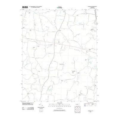
2010 Map of Cassville
USGS Topo · Published 2010About this map
Gum Spring Mountain and High Knob anchor this 2010 landscape in White County, where the topography is defined by distinctive karst and mountain features like Cashdollar Cove and Walker Mountain. This rural Tennessee survey reveals a densely established network of community landmarks, including numerous family and church burial grounds such as Carter Cemetery, Old Zion Cemetery, and Philadelphia Cemetery. The presence of Hutchins College near the northern boundary suggests a history of local educational centers, while the mapping of Boiling Pond and the Darkey Spring Branch illustrates the complex hydrology of the region. Local transport routes like the Old Smithville Hwy S and Roberts Matthews Hwy connect these high-country coves and hollows, including Cane Hollow and Hurd Hollow.
Find a feature on this map
108 named features on this map. Tap any name to fly to it.
Don’t see what you’re looking for? This feature index may not catch every label — zoom into the map to look around manually.
Map Details
Editions of this 2010 Cassville Map
This is the sole edition of this map. No revisions or reprints were ever made.
Other maps of this area

1892 · Pikeville
USGS Topo · 1:125,000

1893 · Mc Minnville
USGS Topo · 1:125,000

1895 · Mc Minnville
USGS Topo · 1:125,000

1895 · Pikeville
USGS Topo · 1:125,000

1897 · Standingstone
USGS Topo · 1:125,000

1898 · Standingstone
USGS Topo · 1:125,000

1943 · Cookeville
USGS Topo · 1:100,000

1944 · Cookeville
USGS Topo · 1:100,000

1953 · Chattanooga
USGS Topo · 1:250,000

1954 · Sparta
USGS Topo · 1:24,000