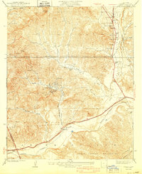
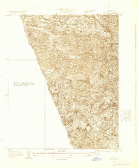
1940 Map of Castaic
USGS Topo · Published 1940About this map
Castaic Creek flows south toward the Santa Clara River in this detailed view of northern Los Angeles County during the late 1930s. The landscape is defined by the steep canyons of the Santa Susana Mountains and the infrastructure of early California travel, featuring the famous Ridge Route and the Southern Pacific railroad line. Settlement patterns cluster along these transit corridors, notably at Castaic Sta and the surrounding waystations such as Foothill Sta and Lindys.
Find a feature on this map
34 named features on this map. Tap any name to fly to it.
Don’t see what you’re looking for? This feature index may not catch every label — zoom into the map to look around manually.
Map Details
Editions of this 1940 Castaic Map
3 editions found
Other maps of this area

1903 · Tejon
USGS Topo · 1:125,000

1903 · Camulos
USGS Topo · 1:125,000

1903 · Santa Susana
USGS Topo · 1:62,500
1929 · Newhall
USGS Topo · 1:24,000

1929 · Saugus
USGS Topo · 1:24,000
1929 · Pico
USGS Topo · 1:24,000

1931 · Red Mountain
USGS Topo · 1:24,000

1931 · Whitaker Peak
USGS Topo · 1:24,000

1931 · Santa Felicia Canyon
USGS Topo · 1:24,000

1931 · Castaic
USGS Topo · 1:24,000