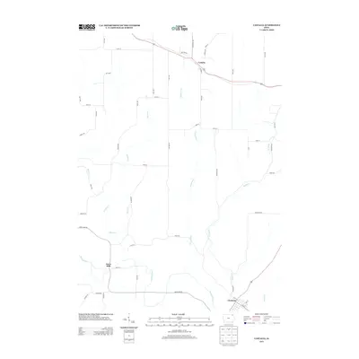
2013 Map of Castalia
USGS Topo · Published 2013About this map
The Turkey River winds through the southern landscape of this Fayette County quadrangle, anchoring the settlements of Clermont and the milling site of Dover Mills. This 2013 survey illustrates the enduring agricultural and hydraulic network of the region, where numerous tributaries like Quinn Cr, Fitzgerald Cr, and Nutting Cr carve through the land to reach the river valley. The infrastructure is a blend of historic transit corridors and modern local routes, most notably the prominent Military Rd that bisects the northern portion near Castalia. This transit pattern, including the Great River Rd, highlights the area's importance as a connective corridor between smaller Iowa communities. For the researcher, the map preserves the exact placement of local farm-to-market roads such as Granite Rd and Eastern Rd as they relate to the natural drainage of Dibble Cr and Sandy Cr.
Find a feature on this map
54 named features on this map. Tap any name to fly to it.
Don’t see what you’re looking for? This feature index may not catch every label — zoom into the map to look around manually.
Map Details
Editions of this 2013 Castalia Map
This is the sole edition of this map. No revisions or reprints were ever made.
Other maps of this area

1901 · Oelwein
USGS Topo · 1:125,000

1906 · Decorah
USGS Topo · 1:125,000

1958 · La Crosse
USGS Topo · 1:250,000

1959 · Dubuque
USGS Topo · 1:250,000

1961 · Dubuque
USGS Topo · 1:250,000

1961 · La Crosse
USGS Topo · 1:250,000

1962 · Dubuque
USGS Topo · 1:250,000

1965 · La Crosse
USGS Topo · 1:250,000

1965 · Elgin
USGS Topo · 1:24,000
1965 · Gunder
USGS Topo · 1:24,000