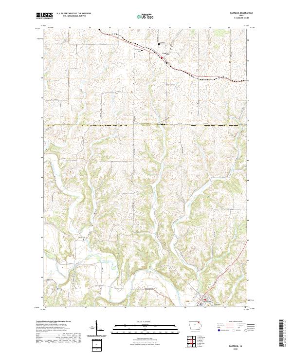
2022 Map of Castalia
USGS Topo · Published 2022About this map
The Turkey River winds through the southern reaches of this Northeast Iowa landscape, where the border between Winneshiek Co and Fayette Co divides a region defined by its deep stream valleys and high ridge farming. Castalia sits in the northern portion of the map, serving as a focal point for the surrounding rural road network that follows the township and range lines. To the south, the terrain becomes more complex as Dibble Cr, Fitzgerald Cr, and Nutting Cr carve through the limestone-rich topography toward the river valley.
Find a feature on this map
59 named features on this map. Tap any name to fly to it.
Don’t see what you’re looking for? This feature index may not catch every label — zoom into the map to look around manually.
Map Details
Editions of this 2022 Castalia Map
This is the sole edition of this map. No revisions or reprints were ever made.
Other maps of this area

1901 · Oelwein
USGS Topo · 1:125,000

1906 · Decorah
USGS Topo · 1:125,000

1958 · La Crosse
USGS Topo · 1:250,000

1959 · Dubuque
USGS Topo · 1:250,000

1961 · Dubuque
USGS Topo · 1:250,000

1961 · La Crosse
USGS Topo · 1:250,000

1962 · Dubuque
USGS Topo · 1:250,000

1965 · La Crosse
USGS Topo · 1:250,000

1965 · Elgin
USGS Topo · 1:24,000
1965 · Gunder
USGS Topo · 1:24,000