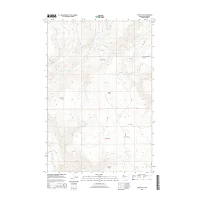
2014 Map of Castile Falls
USGS Topo · Published 2014About this map
Castile Falls sits at the southwestern edge of this Yakima County landscape, where the Klickitat River carves through a network of high ridges and broad plateaus. The drainage patterns of the Piscoe Cr, Yedlick Cr, and Toppenish Cr systems define the territory, separated by significant landforms such as Bullgrouse Ridge and Panther Butte. This area is characterized by a high concentration of Bureau of Indian Affairs routes, including BIA 255 Rd and BIA 219 Rd, which provide access to the interior uplands.
Find a feature on this map
35 named features on this map. Tap any name to fly to it.
Don’t see what you’re looking for? This feature index may not catch every label — zoom into the map to look around manually.
Map Details
Editions of this 2014 Castile Falls Map
This is the sole edition of this map. No revisions or reprints were ever made.
Other maps of this area

1904 · Mount Adams
USGS Topo · 1:125,000

1907 · Mount Adams
USGS Topo · 1:125,000

1950 · Yakima
USGS Topo · 1:250,000

1958 · Yakima
USGS Topo · 1:250,000

1961 · Yakima
USGS Topo · 1:250,000
1969 · Castile Falls
USGS Topo · 1:24,000
1970 · Lost Horse Plateau
USGS Topo · 1:24,000
1970 · Fairview Ridge
USGS Topo · 1:24,000
1970 · Signal Peak
USGS Topo · 1:24,000
1970 · Castile Falls
USGS Topo · 1:24,000