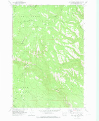
1970 Map of Lost Horse Plateau
USGS Topo · Published 1973About this map
Lost Horse Plateau and the adjacent Lincoln Plateau define the high upland geography of the Yakima Indian Reservation in this 1970 survey. The landscape is dominated by a complex network of drainage basins, most notably the numerous branches of Toppenish Creek and Simcoe Creek. Human presence is sparse and largely focused on seasonal or resource-based infrastructure, such as the Olney Corral and a Gravel Pit.
Find a feature on this map
20 named features on this map. Tap any name to fly to it.
Don’t see what you’re looking for? This feature index may not catch every label — zoom into the map to look around manually.
Map Details
Editions of this 1970 Lost Horse Plateau Map
This is the sole edition of this map. No revisions or reprints were ever made.
Other maps of this area

1904 · Mount Adams
USGS Topo · 1:125,000

1907 · Mount Adams
USGS Topo · 1:125,000

1937 · White Swan
USGS Topo · 1:125,000

1950 · Yakima
USGS Topo · 1:250,000

1957 · Yesmowit Canyon
USGS Topo · 1:24,000
1957 · Willy Dick Canyon
USGS Topo · 1:24,000

1958 · Fort Simcoe
USGS Topo · 1:62,500

1958 · Yakima
USGS Topo · 1:250,000

1961 · Yakima
USGS Topo · 1:250,000
1965 · Mc Kays Butte
USGS Topo · 1:24,000