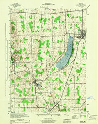
1944 Map of Castile
USGS Topo · Published 1944About this map
Industrial and agricultural life in Wyoming County is centered around the western shores of Silver Lake and the crossing of major rail lines. The Worcester Salt Works at Silver Springs highlights the region's mineral industry, situated at the junction of the Erie and Baltimore and Ohio railroads. These transit corridors dictated the growth of several villages, including Rock Glen, Castile, and the southern edge of Perry.
Find a feature on this map
37 named features on this map. Tap any name to fly to it.
Don’t see what you’re looking for? This feature index may not catch every label — zoom into the map to look around manually.
Map Details
Editions of this 1944 Castile Map
This is the sole edition of this map. No revisions or reprints were ever made.
Other maps of this area

1904 · Batavia
USGS Topo · 1:62,500

1904 · Caledonia
USGS Topo · 1:62,500

1905 · Portage
USGS Topo · 1:62,500

1905 · Nunda
USGS Topo · 1:62,500

1943 · Mount Morris
USGS Topo · 1:24,000

1943 · Warsaw
USGS Topo · 1:24,000

1943 · Nunda
USGS Topo · 1:24,000

1943 · Castile
USGS Topo · 1:24,000

1943 · Portageville
USGS Topo · 1:24,000

1943 · Pike
USGS Topo · 1:24,000