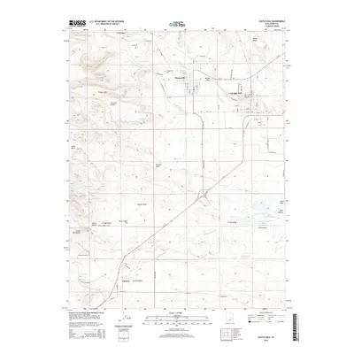
2014 Map of Castle Dale
USGS Topo · Published 2014About this map
Castle Dale and Orangeville anchor this 2014 survey of the central Castle Valley. The landscape is defined by its complex irrigation and industrial water management, featuring the Clipper Canal, Dooley Ditch, and the Emery Plant Reservoir alongside the Utah Power and Light Ash Reservoir. This infrastructure supports a region characterized by prominent geological benches, including Buzzard Bench and Johnson Bench, which overlook the winding course of Cottonwood Cr. Local genealogy and settlement history are preserved through the Castle Dale City Cemetery and Orangeville Cemetery, while the outlying areas show the enduring presence of rural homesteads like Fox Ranch and Blackburns Ranch. Further south, the town of Clawson sits near Peavine Wash, marking the lower extent of this plateau-dominated terrain where desert washes like Paulson Wash and Grimes Wash carve through the sedimentary layers.
Find a feature on this map
71 named features on this map. Tap any name to fly to it.
Don’t see what you’re looking for? This feature index may not catch every label — zoom into the map to look around manually.
Map Details
Editions of this 2014 Castle Dale Map
This is the sole edition of this map. No revisions or reprints were ever made.
Other maps of this area

1885 · Manti
USGS Topo · 1:250,000

1886 · Price River
USGS Topo · 1:250,000

1895 · Manti
USGS Topo · 1:250,000

1896 · Price River
USGS Topo · 1:250,000

1923 · Castle Dale
USGS Topo · 1:62,500

1923 · Hiawatha
USGS Topo · 1:62,500

1925 · Castle Dale
USGS Topo · 1:62,500

1925 · Hiawatha
USGS Topo · 1:62,500

1956 · Price
USGS Topo · 1:250,000

1960 · Price
USGS Topo · 1:250,000