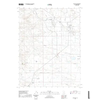
2020 Map of Castle Dale
USGS Topo · Published 2020About this map
Castle Dale and Orangeville serve as the primary hubs of this modern Emery County landscape, where the plateau terrain meets organized agricultural and industrial infrastructure. The presence of the Hunter Plant Byp and Coal Haul Rd signals the area's continued connection to regional energy production, while irrigation systems like the Clipper Canal and Dooley Ditch support life along Cottonwood Cr. Further south, the town of Clawson sits at the base of the Clawson Bench, overlooking the broad expanse of Castle Valley. The geography is defined by a series of prominent level surfaces including Danish Bench, Buzzard Bench, and Johnson Bench, which are bisected by drainages such as Rock Canyon Cr and Peavine Wash. Genealogists will find the Castle Dale City Cem, Orangeville Cem, and Clawson Cem clearly marked across the three distinct community centers.
Find a feature on this map
50 named features on this map. Tap any name to fly to it.
Don’t see what you’re looking for? This feature index may not catch every label — zoom into the map to look around manually.
Map Details
Editions of this 2020 Castle Dale Map
This is the sole edition of this map. No revisions or reprints were ever made.
Other maps of this area

1885 · Manti
USGS Topo · 1:250,000

1886 · Price River
USGS Topo · 1:250,000

1895 · Manti
USGS Topo · 1:250,000

1896 · Price River
USGS Topo · 1:250,000

1923 · Castle Dale
USGS Topo · 1:62,500

1923 · Hiawatha
USGS Topo · 1:62,500

1925 · Castle Dale
USGS Topo · 1:62,500

1925 · Hiawatha
USGS Topo · 1:62,500

1956 · Price
USGS Topo · 1:250,000

1960 · Price
USGS Topo · 1:250,000