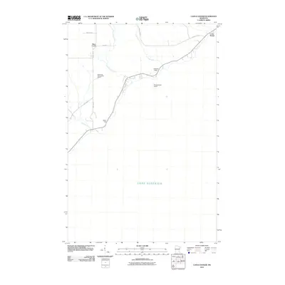
2010 Map of Castle Danger
USGS Topo · Published 2010About this map
Lake Superior dominates the lower portion of this quadrangle, defining the shoreline of Lake County where the North Shore's dramatic geology meets the water. The small settlement of Castle Danger sits at the northeastern edge, while the inland community of Silver Creek is positioned near the western boundary. Significant coastal features like Lafayette Bluff and Silver Cliff rise above the water, framing the mouth of the Encampment River and the nearby Encampment Island. The transportation network is anchored by County Hwy-3 and several township roads, including Twp Hwy 32, which connect these lakeside outposts to the Weideman International Airport. This survey provides a clear view of the drainage patterns of Crow Creek as it moves toward the lake, illustrating the transition from the wooded interior to the rocky lakefront in the early 21st century.
Find a feature on this map
15 named features on this map. Tap any name to fly to it.
Don’t see what you’re looking for? This feature index may not catch every label — zoom into the map to look around manually.
Map Details
Editions of this 2010 Castle Danger Map
This is the sole edition of this map. No revisions or reprints were ever made.
Other maps of this area

1943 · Port Wing
USGS Topo · 1:48,000

1946 · Port Wing
USGS Topo · 1:48,000

1953 · Ashland
USGS Topo · 1:250,000

1954 · Two Harbors
USGS Topo · 1:250,000

1956 · Split Rock Point
USGS Topo · 1:24,000

1956 · Split Rock Point
USGS Topo · 1:62,500

1957 · Two Harbors
USGS Topo · 1:250,000

1957 · Two Harbors
USGS Topo · 1:62,500

1957 · Two Harbors
USGS Topo · 1:24,000

1957 · Two Harbors NE
USGS Topo · 1:24,000