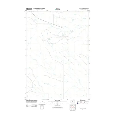
2012 Map of Castle Rock
USGS Topo · Published 2012About this map
Castle Rock serves as the central landmark in this expanse of northern Butte County, situated at a junction of regional roads that traverse the high plains. The landscape is defined by a dendritic network of drainage systems, including the meandering paths of Frog Cr and the extensive Buck Pasture Cr. These seasonal watercourses, alongside Willow Cr, S Willow Cr, and Middle Cr, illustrate the subtle topographic variations and drainage patterns essential to ranching and land use in this part of South Dakota. The map captures the spatial relationship between the isolated settlement and the vast open range, where long-distance roads are the primary conduits through the prairie.
Find a feature on this map
6 named features on this map. Tap any name to fly to it.
Don’t see what you’re looking for? This feature index may not catch every label — zoom into the map to look around manually.
Map Details
Editions of this 2012 Castle Rock Map
This is the sole edition of this map. No revisions or reprints were ever made.
Other maps of this area

1906 · Two Top
USGS Topo · 1:62,500

1907 · Belle Fourche
USGS Topo · 1:125,000

1913 · Newell
USGS Topo · 1:125,000

1935 · Hoover
USGS Topo · 1:125,000

1935 · Harding
USGS Topo · 1:125,000

1953 · Rapid City
USGS Topo · 1:250,000

1954 · Lemmon
USGS Topo · 1:250,000

1957 · Lemmon
USGS Topo · 1:250,000

1957 · Rapid City
USGS Topo · 1:250,000
1965 · Two Top Butte East
USGS Topo · 1:24,000