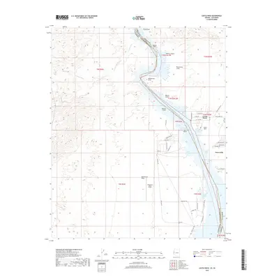
2018 Map of Castle Rock
USGS Topo · Published 2018About this map
Lake Havasu dominates this landscape along the border of Arizona and California, where the Colorado River corridor transitions through the Mojave Desert. The map records the residential expansion in communities like Crystal Beach and Desert Hills, positioned on the eastern bluffs overlooking the water. Topographic details illustrate the dramatic contrast between the flat reaches of the Chemehuevi Valley and the steep, eroded walls of Mohave Canyon. The river channel itself is defined by unique features such as Blankenship Bend and The Island, while the shoreline is carved into numerous recreational inlets including Castle Rock Bay and Jops Harbor. Infrastructure like the Chemehuevi Valley Airport and a network of desert trails, such as Chemehuevi Trl and Sunrise Trl, reflect the area's development as a hub for both transportation and desert living in Mohave County.
Find a feature on this map
56 named features on this map. Tap any name to fly to it.
Don’t see what you’re looking for? This feature index may not catch every label — zoom into the map to look around manually.
Map Details
Editions of this 2018 Castle Rock Map
This is the sole edition of this map. No revisions or reprints were ever made.
Other maps of this area

1903 · Needles
USGS Topo · 1:125,000

1904 · Needles Special
USGS Topo · 1:125,000

1911 · Parker
USGS Topo · 1:125,000

1943 · Topock
USGS Topo · 1:62,500

1943 · Whipple Mts.
USGS Topo · 1:62,500

1950 · Topock
USGS Topo · 1:62,500

1950 · Sawtooth Range
USGS Topo · 1:62,500

1950 · Whipple Mts
USGS Topo · 1:62,500

1950 · Savahia Peak
USGS Topo · 1:62,500

1951 · Topock
USGS Topo · 1:62,500