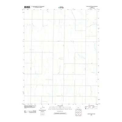
2009 Map of Castle Rock NE
USGS Topo · Published 2009About this map
Big Creek meanders across the northern plains of this Trego County landscape, carving subtle drainage patterns through the agricultural terrain. The map's geometric road grid, defined by routes like Banner Rd and Voda Rd, illustrates the persistent township-and-range surveying system that shaped Kansas settlement. In the south, the intersection of north-south corridors with Trego Center Rd points toward the community's local infrastructure and centers of rural activity. The eastern portion of the quadrangle is defined by the branching hydrography of Downer Creek and its East Branch Downer Creek, providing essential water resources in an otherwise dry, high-plains environment. This 2009 edition preserves the specific alignment of local infrastructure, including specialized routes such as Landfill Rd, during a period of modern land management.
Find a feature on this map
7 named features on this map. Tap any name to fly to it.
Don’t see what you’re looking for? This feature index may not catch every label — zoom into the map to look around manually.
Map Details
Editions of this 2009 Castle Rock NE Map
This is the sole edition of this map. No revisions or reprints were ever made.
Other maps of this area

1893 · Ellis
USGS Topo · 1:125,000

1893 · Hill
USGS Topo · 1:125,000

1954 · Goodland
USGS Topo · 1:250,000

1955 · Great Bend
USGS Topo · 1:250,000

1955 · Scott City
USGS Topo · 1:250,000

1955 · Beloit
USGS Topo · 1:250,000

1956 · Goodland
USGS Topo · 1:250,000

1957 · Goodland
USGS Topo · 1:250,000

1957 · Great Bend
USGS Topo · 1:250,000

1958 · Great Bend
USGS Topo · 1:250,000