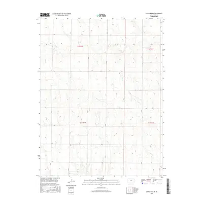
2015 Map of Castle Rock NE
USGS Topo · Published 2015About this map
Big Cr and Downer Cr wind through the expansive high plains of Trego County, defining the drainage patterns of this sparsely settled landscape. The map reveals a highly structured agricultural grid, where north-south thoroughfares like 130 Ave and 160 Ave intersect with east-west rural roads including K Rd and R Rd. This systematic layout, established by the Public Land Survey System, reflects the methodical division of Kansas farmland. The terrain is marked by subtle elevation changes as the land slopes toward the East Br Downer Cr, illustrating the relationship between the natural watercourses and the human-imposed boundary lines of t12s r25w and t13s r24w.
Find a feature on this map
21 named features on this map. Tap any name to fly to it.
Don’t see what you’re looking for? This feature index may not catch every label — zoom into the map to look around manually.
Map Details
Editions of this 2015 Castle Rock NE Map
This is the sole edition of this map. No revisions or reprints were ever made.
Other maps of this area

1893 · Ellis
USGS Topo · 1:125,000

1893 · Hill
USGS Topo · 1:125,000

1954 · Goodland
USGS Topo · 1:250,000

1955 · Great Bend
USGS Topo · 1:250,000

1955 · Scott City
USGS Topo · 1:250,000

1955 · Beloit
USGS Topo · 1:250,000

1956 · Goodland
USGS Topo · 1:250,000

1957 · Goodland
USGS Topo · 1:250,000

1957 · Great Bend
USGS Topo · 1:250,000

1958 · Great Bend
USGS Topo · 1:250,000