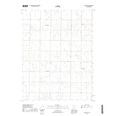
2018 Map of Castle Rock NE
USGS Topo · Published 2018About this map
The rolling plains of Trego County are defined here by a series of intermittent drainage systems carving through the high Kansas prairie. Big Cr meanders across the northern sections, while the headwaters of Downer Cr and its E Br Downer Cr originate in the central and eastern portions of the quadrangle. This area reflects the classic township and range system, with a rigid grid of local thoroughfares such as K Rd and 150 Ave that facilitate access across this agricultural landscape. The lack of concentrated town sites emphasizes the region's character as a working ranching and farming territory, where the topography of the draws and creek beds dictated the placement of early homesteads and road networks.
Find a feature on this map
21 named features on this map. Tap any name to fly to it.
Don’t see what you’re looking for? This feature index may not catch every label — zoom into the map to look around manually.
Map Details
Editions of this 2018 Castle Rock NE Map
This is the sole edition of this map. No revisions or reprints were ever made.
Other maps of this area

1893 · Ellis
USGS Topo · 1:125,000

1893 · Hill
USGS Topo · 1:125,000

1954 · Goodland
USGS Topo · 1:250,000

1955 · Great Bend
USGS Topo · 1:250,000

1955 · Scott City
USGS Topo · 1:250,000

1955 · Beloit
USGS Topo · 1:250,000

1956 · Goodland
USGS Topo · 1:250,000

1957 · Goodland
USGS Topo · 1:250,000

1957 · Great Bend
USGS Topo · 1:250,000

1958 · Great Bend
USGS Topo · 1:250,000