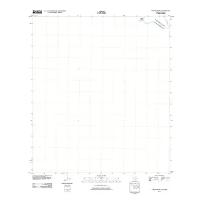
2010 Map of Castolon OE S
USGS Topo · Published 2010About this map
Santa Elena Crossing serves as the primary focal point of this border survey, marking a historic point of passage across the Rio Grande. Situated where the international boundary separates the United States of America from Estados Unidos Mexicanos, the map highlights the sparse infrastructure of this desert corridor. The unpaved route of River Rd W follows the northern bank of the river, providing the only significant access through this arid landscape. This map captures the remote character of the Big Bend region, where the river's path is the defining geographic and political feature, long before modern fencing or extensive development altered the visual landscape of the international line.
Find a feature on this map
5 named features on this map. Tap any name to fly to it.
Don’t see what you’re looking for? This feature index may not catch every label — zoom into the map to look around manually.
Map Details
Editions of this 2010 Castolon OE S Map
This is the sole edition of this map. No revisions or reprints were ever made.
Other maps of this area

1903 · Chisos Mountains
USGS Topo · 1:125,000

1903 · Terlingua
USGS Topo · 1:125,000

1904 · Terlingua
USGS Topo · 1:125,000

1905 · Chisos Mountains
USGS Topo · 1:125,000

1959 · Emory Peak
USGS Topo · 1:250,000

1965 · Emory Peak
USGS Topo · 1:250,000

1971 · Cerro Castellan
USGS Topo · 1:24,000
1971 · Castolon
USGS Topo · 1:24,000
1971 · Smoky Creek
USGS Topo · 1:24,000
1971 · Mesa De Anguila
USGS Topo · 1:24,000