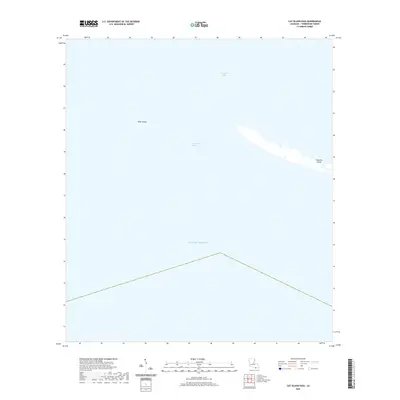
2020 Map of Cat Island Pass
USGS Topo · Published 2020About this map
Terrebonne Bay meets the open waters of the Gulf of Mexico in this coastal survey of Louisiana’s southern reaches. The landscape is defined by the fragile barrier system of Timbalier Island and Wine Island, which serve as the primary buffer between the inland marshes and the gulf. These landforms shape Cat Island Pass, a critical waterway for navigation into the protected bay. The map illustrates the sparse, water-dominant environment of the 21st century, where tidal movement and shifting sands are the primary architects of the terrain. This document is essential for understanding the modern shoreline configuration and the relationship between the barrier islands and the expansive estuarine system of the parish.
Find a feature on this map
6 named features on this map. Tap any name to fly to it.
Don’t see what you’re looking for? This feature index may not catch every label — zoom into the map to look around manually.
Map Details
Editions of this 2020 Cat Island Pass Map
This is the sole edition of this map. No revisions or reprints were ever made.
Other maps of this area

1894 · Timbalier
USGS Topo · 1:62,500

1935 · Cocodrie
USGS Topo · 1:31,680

1935 · Timbalier Island
USGS Topo · 1:31,680
1945 · Cocodrie
USGS Topo · 1:31,680

1945 · Lake La Graisse
USGS Topo · 1:31,680

1945 · New Orleans
USGS Topo · 1:250,000

1946 · Lake La Graisse
USGS Topo · 1:31,680

1947 · Jacko Bay
USGS Topo · 1:31,680
1953 · Eastern Isles Dernieres
USGS Topo · 1:24,000
1953 · Jacko Bay
USGS Topo · 1:24,000