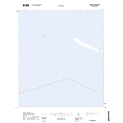
2024 Map of Cat Island Pass
USGS Topo · Published 2024About this map
Timbalier Island stretches across the eastern reach of this coastal survey, serving as a narrow barrier between the open waters of the Gulf of Mexico and the interior expanse of Terrebonne Bay. The map documents a highly dynamic maritime landscape defined by shifting sands and the deep-water channel of Cat Island Pass. To the west, the isolated remnant of Wine Island stands as a point of reference for researchers tracking the ongoing transformation of the Louisiana shoreline. This document provides a precise record of the parish’s southernmost reach, where the delta meets the sea and where traditional barrier landforms continue to evolve against the elements.
Find a feature on this map
5 named features on this map. Tap any name to fly to it.
Don’t see what you’re looking for? This feature index may not catch every label — zoom into the map to look around manually.
Map Details
Editions of this 2024 Cat Island Pass Map
This is the sole edition of this map. No revisions or reprints were ever made.
Other maps of this area

1894 · Timbalier
USGS Topo · 1:62,500

1935 · Cocodrie
USGS Topo · 1:31,680

1935 · Timbalier Island
USGS Topo · 1:31,680
1945 · Cocodrie
USGS Topo · 1:31,680

1945 · Lake La Graisse
USGS Topo · 1:31,680

1945 · New Orleans
USGS Topo · 1:250,000

1946 · Lake La Graisse
USGS Topo · 1:31,680

1947 · Jacko Bay
USGS Topo · 1:31,680
1953 · Eastern Isles Dernieres
USGS Topo · 1:24,000
1953 · Jacko Bay
USGS Topo · 1:24,000