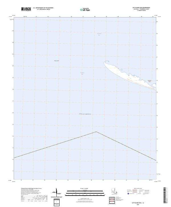
2025 Map of Cat Island Pass
USGS Topo · Published 2025About this map
Timbalier Island stretches across the eastern edge of this coastal survey, serving as a critical barrier between the open Gulf of America and the sheltered waters of Terrebonne Bay. This maritime environment is defined by its shifting shoals and vital navigational channels, most notably Cat Island Pass, which provides deep-water access between the gulf and the interior bay. To the west, the remnants of Wine Island stand as a marker of the dynamic Louisiana coastline where land and sea are in constant flux. The map documents a landscape almost entirely dominated by water and salt marsh, capturing the sparse remains of the barrier island chain that protects the mainland of Terrebonne Parish from the elements of the open sea.
Find a feature on this map
5 named features on this map. Tap any name to fly to it.
Don’t see what you’re looking for? This feature index may not catch every label — zoom into the map to look around manually.
Map Details
Editions of this 2025 Cat Island Pass Map
This is the sole edition of this map. No revisions or reprints were ever made.
Other maps of this area

1894 · Timbalier
USGS Topo · 1:62,500

1935 · Cocodrie
USGS Topo · 1:31,680

1935 · Timbalier Island
USGS Topo · 1:31,680
1945 · Cocodrie
USGS Topo · 1:31,680

1945 · Lake La Graisse
USGS Topo · 1:31,680

1945 · New Orleans
USGS Topo · 1:250,000

1946 · Lake La Graisse
USGS Topo · 1:31,680

1947 · Jacko Bay
USGS Topo · 1:31,680
1953 · Eastern Isles Dernieres
USGS Topo · 1:24,000
1953 · Jacko Bay
USGS Topo · 1:24,000