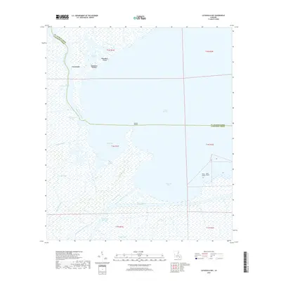
2018 Map of Catahoula Bay
USGS Topo · Published 2018About this map
Tabatiere Perdue and Camardelle sit at the northern edge of this coastal landscape, where the labyrinthine waterways of southern Louisiana meet the open expanse of Lake Salvador. The terrain is defined by a dense network of bayous, including Bayou des Allemands and Bayou Vacherie, which weave through the wetlands before reaching Catahoula Bay. This 2018 survey reveals the critical engineering of the region's maritime economy, showing the path of the Intracoastal Waterway and industrial arteries like Harvey Canal Number Two and the Wickey Canal. Further south, small settlements such as Shell Beach and Point Chicot occupy the narrow land fragments near Temple Bay. The proximity of named points like Grosse Pointe illustrates how subtle elevation changes dictate settlement patterns in this delicate environment where land and water constantly intersect.
Find a feature on this map
29 named features on this map. Tap any name to fly to it.
Don’t see what you’re looking for? This feature index may not catch every label — zoom into the map to look around manually.
Map Details
Editions of this 2018 Catahoula Bay Map
This is the sole edition of this map. No revisions or reprints were ever made.
Other maps of this area

1891 · Hahnville
USGS Topo · 1:62,500

1891 · New Orleans
USGS Topo · 1:62,500

1892 · Barataria
USGS Topo · 1:62,500

1892 · Cut-Off
USGS Topo · 1:62,500

1932 · New Orleans SW
USGS Topo · 1:31,680

1932 · Hahnville SW
USGS Topo · 1:31,680

1939 · Cut-Off
USGS Topo · 1:62,500
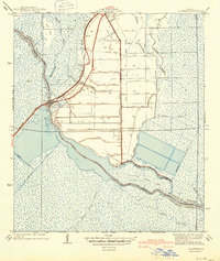
1940 · Allemands
USGS Topo · 1:31,680

1941 · Cut-Off
USGS Topo · 1:62,500

1941 · Barataria
USGS Topo · 1:62,500