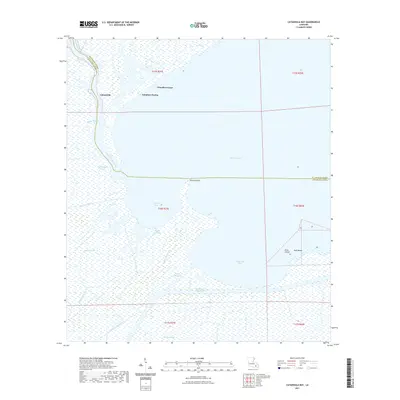
2021 Map of Catahoula Bay
USGS Topo · Published 2021About this map
The vast wetlands where St. Charles Parish meets Lafourche Parish are defined by a complex network of bayous and coastal inlets. Centered on the open waters of Lake Salvador and Catahoula Bay, this map reveals the intricate natural and man-made hydrology of the Louisiana coast. The Intracoastal Waterway cuts through the southern section, intersecting with drainage features like the Wickey Canal and Canal Tisamond Foret. Named landforms such as Tabatiere Perdue, Camardelle, and Grosse Pointe emerge from the marsh, providing distinct markers in an otherwise fluid landscape.
Find a feature on this map
27 named features on this map. Tap any name to fly to it.
Don’t see what you’re looking for? This feature index may not catch every label — zoom into the map to look around manually.
Map Details
Editions of this 2021 Catahoula Bay Map
This is the sole edition of this map. No revisions or reprints were ever made.
Other maps of this area

1891 · Hahnville
USGS Topo · 1:62,500

1891 · New Orleans
USGS Topo · 1:62,500

1892 · Barataria
USGS Topo · 1:62,500

1892 · Cut-Off
USGS Topo · 1:62,500

1932 · New Orleans SW
USGS Topo · 1:31,680

1932 · Hahnville SW
USGS Topo · 1:31,680

1939 · Cut-Off
USGS Topo · 1:62,500
1940 · Allemands
USGS Topo · 1:31,680

1941 · Cut-Off
USGS Topo · 1:62,500

1941 · Barataria
USGS Topo · 1:62,500