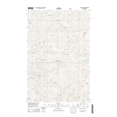
2013 Map of Cataract Peak
USGS Topo · Published 2013About this map
Coeur d'Alene National Forest dominates this mountain landscape, defined by a complex network of ridges and drainages that feed into the Little N Fork Coeur d'Alene River. High points such as Cataract Peak, Colt Mtn, and Echo Peak anchor the terrain, while travelers move through high passes like Solitare Saddle and Independence Saddle. The area's hydrology is exceptionally dense, featuring numerous named creeks including W Fork Solitaire Cr, Arguement Cr, and Potter Cr.
Find a feature on this map
50 named features on this map. Tap any name to fly to it.
Don’t see what you’re looking for? This feature index may not catch every label — zoom into the map to look around manually.
Map Details
Editions of this 2013 Cataract Peak Map
This is the sole edition of this map. No revisions or reprints were ever made.
Other maps of this area

1903 · Rathdrum
USGS Topo · 1:125,000

1909 · Cataldo
USGS Topo · 1:125,000

1911 · Cataldo
USGS Topo · 1:125,000

1955 · Spokane
USGS Topo · 1:250,000

1957 · Kingston
USGS Topo · 1:62,500

1957 · Lane
USGS Topo · 1:62,500

1958 · Spokane
USGS Topo · 1:250,000

1961 · Bayview
USGS Topo · 1:24,000
1961 · Lakeview
USGS Topo · 1:24,000

1961 · Lakeview
USGS Topo · 1:62,500