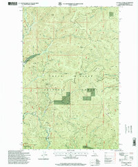
1996 Map of Cataract Peak
USGS Topo · Published 1999About this map
The Little North Fork Coeur D'Alene River winds through the western edge of this landscape, defining a network of steep drainages within the Coeur D'Alene National Forest. By the late 1990s, the area shows a distinct pattern of forest management and early-century resource extraction, marked by various prospects, an adit, and several gravel pits used for local infrastructure. High-altitude landmarks like Cataract Peak and Colt Mountain overlook a complex system of ridges and saddles, including Solitaire Saddle and Cataract Ridge.
Find a feature on this map
58 named features on this map. Tap any name to fly to it.
Don’t see what you’re looking for? This feature index may not catch every label — zoom into the map to look around manually.
Map Details
Editions of this 1996 Cataract Peak Map
This is the sole edition of this map. No revisions or reprints were ever made.
Other maps of this area

1903 · Rathdrum
USGS Topo · 1:125,000

1909 · Cataldo
USGS Topo · 1:125,000

1911 · Cataldo
USGS Topo · 1:125,000

1955 · Spokane
USGS Topo · 1:250,000

1957 · Kingston
USGS Topo · 1:62,500

1957 · Lane
USGS Topo · 1:62,500

1958 · Spokane
USGS Topo · 1:250,000

1961 · Bayview
USGS Topo · 1:24,000
1961 · Lakeview
USGS Topo · 1:24,000

1961 · Lakeview
USGS Topo · 1:62,500