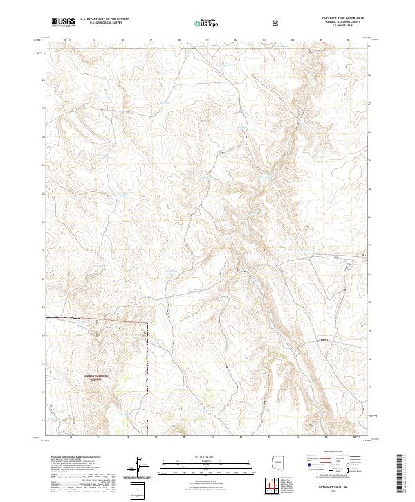
2021 Map of Cataract Tank
USGS Topo · Published 2021About this map
Kaibab National Forest lands dominate this high-plateau landscape, where water management is the primary evidence of human activity. The terrain is deeply incised by Cataract Canyon, with the seasonal Cataract Cr winding through its floor. This arid environment required a network of man-made reservoirs, or tanks, to support cattle ranching and wildlife. Named features like Frenchman Tank, Yeager Tank, and Flying H Tank reflect the history of local land use and grazing rights. Navigation across this territory is facilitated by primitive routes such as PB RD and Old S RD, which connect these isolated water sources. To the south, Mesa Tank and Burro Spring provide further evidence of the critical importance of reliable water in this desert forest, marking points of interest for those studying the ranching heritage of Coconino County.
Find a feature on this map
28 named features on this map. Tap any name to fly to it.
Don’t see what you’re looking for? This feature index may not catch every label — zoom into the map to look around manually.
Map Details
Editions of this 2021 Cataract Tank Map
This is the sole edition of this map. No revisions or reprints were ever made.
Other maps of this area

1886 · Chino
USGS Topo · 1:250,000

1891 · Chino
USGS Topo · 1:250,000

1922 · Williams
USGS Topo · 1:125,000

1948 · Williams
USGS Topo · 1:250,000

1954 · Williams
USGS Topo · 1:250,000

1956 · Williams
USGS Topo · 1:250,000

1960 · Williams
USGS Topo · 1:250,000
1960 · Williams
USGS Topo · 1:62,500

1961 · Williams
USGS Topo · 1:250,000

1962 · Valle
USGS Topo · 1:62,500