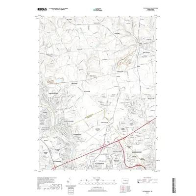
2019 Map of Catasauqua
USGS Topo · Published 2019About this map
The Lehigh River valley serves as a central artery for industrial and residential density between Northampton and Allentown in this 2019 survey. Extensive transportation networks, including the Norfolk Southern rail line and the Lehigh Valley International Airport, define the movement of goods and people across the Northampton Co and Lehigh Co border. The map captures a high concentration of memorial sites and religious landmarks, such as Gethsemane Cem of Saint Marys and Saint John the Baptist Roman Catholic Cem, which reflect the long-standing ethnic and communal settlements of the region.
Find a feature on this map
367 named features on this map. Tap any name to fly to it.
Don’t see what you’re looking for? This feature index may not catch every label — zoom into the map to look around manually.
Map Details
Editions of this 2019 Catasauqua Map
This is the sole edition of this map. No revisions or reprints were ever made.
Other maps of this area

1894 · Allentown
USGS Topo · 1:62,500

1902 · Slatington
USGS Topo · 1:62,500

1914 · Wind Gap
USGS Topo · 1:62,500

1916 · Wind Gap
USGS Topo · 1:62,500

1922 · Mauch Chunk
USGS Topo · 1:62,500

1924 · Mauch Chunk
USGS Topo · 1:62,500

1937 · Allentown West
USGS Topo · 1:48,000

1939 · Allentown
USGS Topo · 1:62,500

1942 · Allentown West
USGS Topo · 1:62,500

1943 · Mauch Chunk
USGS Topo · 1:62,500