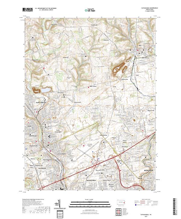
2023 Map of Catasauqua
USGS Topo · Published 2023About this map
The Lehigh River corridor serves as the industrial and social spine of this landscape, anchoring a dense network of settlements like Northampton, Catasauqua, and Coplay. The transition from riverbank industry to the rolling heights of Sauerkraut Hill and Klein Hill is marked by a deep concentration of ethnic and denominational burial grounds, including the Assumption of Virgin Mary Ukrainian Orthodox Cem and Holy Trinity Russian Orthodox Cem, reflecting the diverse immigrant workforce that built these borough communities.
Find a feature on this map
84 named features on this map. Tap any name to fly to it.
Don’t see what you’re looking for? This feature index may not catch every label — zoom into the map to look around manually.
Map Details
Editions of this 2023 Catasauqua Map
This is the sole edition of this map. No revisions or reprints were ever made.
Other maps of this area

1894 · Allentown
USGS Topo · 1:62,500

1902 · Slatington
USGS Topo · 1:62,500

1914 · Wind Gap
USGS Topo · 1:62,500

1916 · Wind Gap
USGS Topo · 1:62,500

1922 · Mauch Chunk
USGS Topo · 1:62,500

1924 · Mauch Chunk
USGS Topo · 1:62,500

1937 · Allentown West
USGS Topo · 1:48,000

1939 · Allentown
USGS Topo · 1:62,500

1942 · Allentown West
USGS Topo · 1:62,500

1943 · Mauch Chunk
USGS Topo · 1:62,500