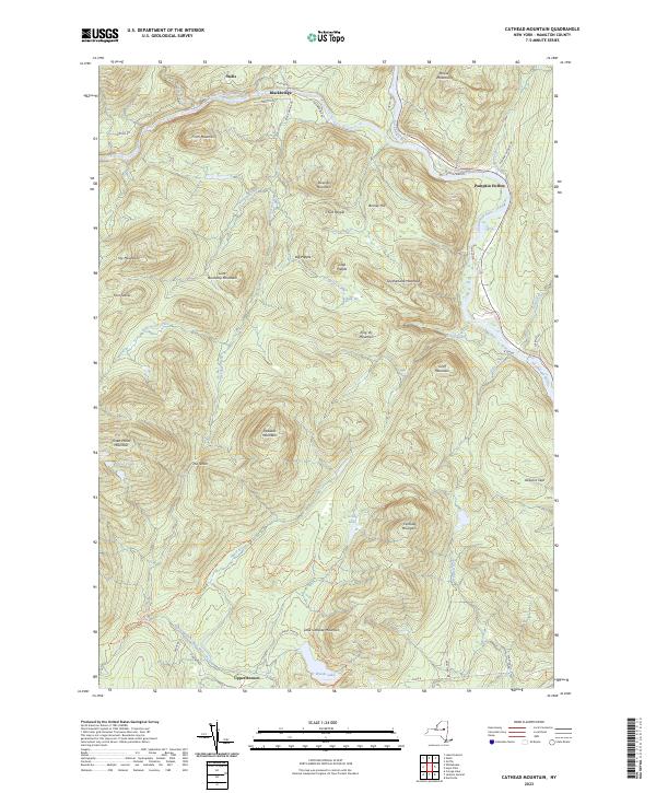
2023 Map of Cathead Mountain
USGS Topo · Published 2023About this map
The West Branch Sacandaga River carves a deep valley through this Adirondack landscape, where the small settlements of Wells and Blackbridge mark the northern reaches of the terrain. The topography is dominated by numerous high peaks including Cathead Mountain, Wallace Mountain, and Three Ponds Mountain, reflecting the densely forested and steep character of Hamilton County. For hikers and outdoor historians, the iconic Northville-Placid Trl is clearly delineated as it winds past Grants Lake and toward Upper Benson. The map details a network of early river-access points and remote locations like Pumpkin Hollow and the State Campsite, illustrating the area's long-standing tradition of seasonal residency and wilderness recreation. This modern survey captures the enduring geography of the Sacandaga valley, showing how traditional travel corridors like W River Rd continue to follow the natural contours of the river banks.
Find a feature on this map
58 named features on this map. Tap any name to fly to it.
Don’t see what you’re looking for? This feature index may not catch every label — zoom into the map to look around manually.
Map Details
Editions of this 2023 Cathead Mountain Map
This is the sole edition of this map. No revisions or reprints were ever made.
Other maps of this area

1899 · Broadalbin
USGS Topo · 1:62,500

1902 · Broadalbin
USGS Topo · 1:62,500

1903 · Gloversville
USGS Topo · 1:62,500

1907 · Lake Pleasant
USGS Topo · 1:62,500

1910 · Stony Creek
USGS Topo · 1:62,500

1943 · Gloversville
USGS Topo · 1:62,500

1945 · Caroga Lake
USGS Topo · 1:24,000

1945 · Northville
USGS Topo · 1:24,000
1945 · Jackson Summit
USGS Topo · 1:24,000
1946 · Jackson Summit
USGS Topo · 1:24,000