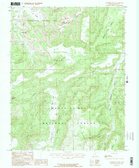
1985 Map of Cathedral Butte
USGS Topo · Published 1985About this map
Canyonlands National Park and the Manti-La Sal National Forest meet in this high-elevation landscape, where the geology of the Colorado Plateau defines the human geography. The map shows a transition from the desert mesa systems to the forested highlands of the Davis Buttes and Maverick Point. Notable landmarks such as Wedding Ring Arch and Cleft Arch are documented in the northern reaches, while the central Cathedral Mesa rises above the winding corridor of Salt Creek. Human activity is marked by a network of trails and resource extraction, visible in the Pack Trail traversing Stevens Canyon and an isolated Prospect and Adit near the edge of Bridger Jack Mesa. The inclusion of Mormon Pasture and Mormon Pasture Point reflects the historical grazing patterns of early Utah settlers in this demanding terrain.
Find a feature on this map
32 named features on this map. Tap any name to fly to it.
Don’t see what you’re looking for? This feature index may not catch every label — zoom into the map to look around manually.
Map Details
Editions of this 1985 Cathedral Butte Map
2 editions found
Other maps of this area

1885 · La Sal
USGS Topo · 1:250,000

1886 · Abajo
USGS Topo · 1:250,000

1892 · Abajo
USGS Topo · 1:250,000

1893 · Abajo
USGS Topo · 1:250,000

1935 · Elk Ridge
USGS Topo · 1:96,000

1940 · Elk Ridge
USGS Topo · 1:125,000

1953 · The Needles
USGS Topo · 1:62,500

1954 · Elk Ridge 1 SW
USGS Topo · 1:24,000

1954 · Elk Ridge 2 SE
USGS Topo · 1:24,000

1954 · Elk Ridge 1 NW
USGS Topo · 1:24,000