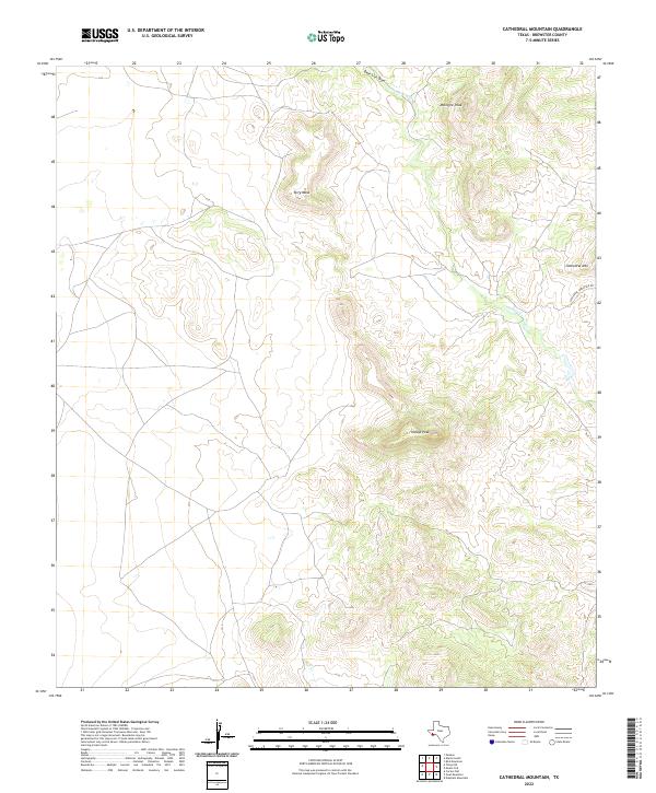
2022 Map of Cathedral Mountain
USGS Topo · Published 2022About this map
Mcintyre Peak and Terry Mesa anchor this landscape of the Davis Mountains region in Brewster County. The topography is defined by significant volcanic remnants and high-elevation landforms, including the prominent summit of Cathedral Mtn and the distinct rise of Haleys Peak. These features reflect a complex geological history that dictates the flow of intermittent watercourses such as Deer Lick Draw and Calamity Cr. Access through this remote high-desert environment is limited, with Cathedral Mountain Rd providing the primary route into the interior. The drainage patterns of Goat Cr and its tributaries show how water moves through the high-relief terrain, illustrating the natural boundaries that have long influenced ranching and land use in this part of West Texas.
Find a feature on this map
8 named features on this map. Tap any name to fly to it.
Don’t see what you’re looking for? This feature index may not catch every label — zoom into the map to look around manually.
Map Details
Editions of this 2022 Cathedral Mountain Map
This is the sole edition of this map. No revisions or reprints were ever made.
Other maps of this area

1895 · Alpine
USGS Topo · 1:125,000

1954 · Fort Stockton
USGS Topo · 1:250,000

1958 · Fort Stockton
USGS Topo · 1:250,000

1972 · Bird Mountain
USGS Topo · 1:24,000

1972 · Paisano
USGS Topo · 1:24,000

1972 · Alpine South
USGS Topo · 1:24,000

1973 · Fort Stockton
USGS Topo · 1:250,000
1983 · Mount Ord
USGS Topo · 1:24,000
1983 · Cactus Flat
USGS Topo · 1:24,000
1983 · Goat Mountain
USGS Topo · 1:24,000