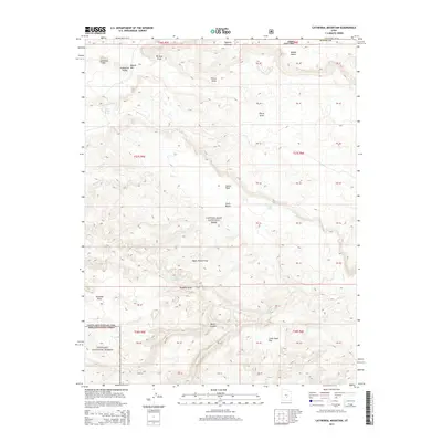
2014 Map of Cathedral Mountain
USGS Topo · Published 2014About this map
Capitol Reef National Park and Fishlake National Forest converge in this high-elevation desert landscape, defined by dramatic geological formations and deep canyons. The northern reaches are anchored by Cathedral Mtn and the distinct monoliths of Cathedral Valley, where the terrain drops sharply into Hartnet Draw and Pierce Draw. This area of Wayne County is characterized by its exposure of the Water Pocket Fold, a massive monocline that dictates the flow of seasonal drainages like Deep Cr and Polk Cr.
Find a feature on this map
47 named features on this map. Tap any name to fly to it.
Don’t see what you’re looking for? This feature index may not catch every label — zoom into the map to look around manually.
Map Details
Editions of this 2014 Cathedral Mountain Map
This is the sole edition of this map. No revisions or reprints were ever made.
Other maps of this area

1885 · Fish Lake
USGS Topo · 1:250,000

1896 · Fish Lake
USGS Topo · 1:250,000

1952 · Notom 2 NW
USGS Topo · 1:24,000

1952 · Notom 2 SE
USGS Topo · 1:24,000

1952 · Notom 2 SW
USGS Topo · 1:24,000

1952 · Notom 2 NE
USGS Topo · 1:24,000

1952 · Notom 1 SW
USGS Topo · 1:24,000

1952 · Torrey
USGS Topo · 1:62,500

1954 · Fruita
USGS Topo · 1:62,500
1954 · Notom 1 NW
USGS Topo · 1:24,000