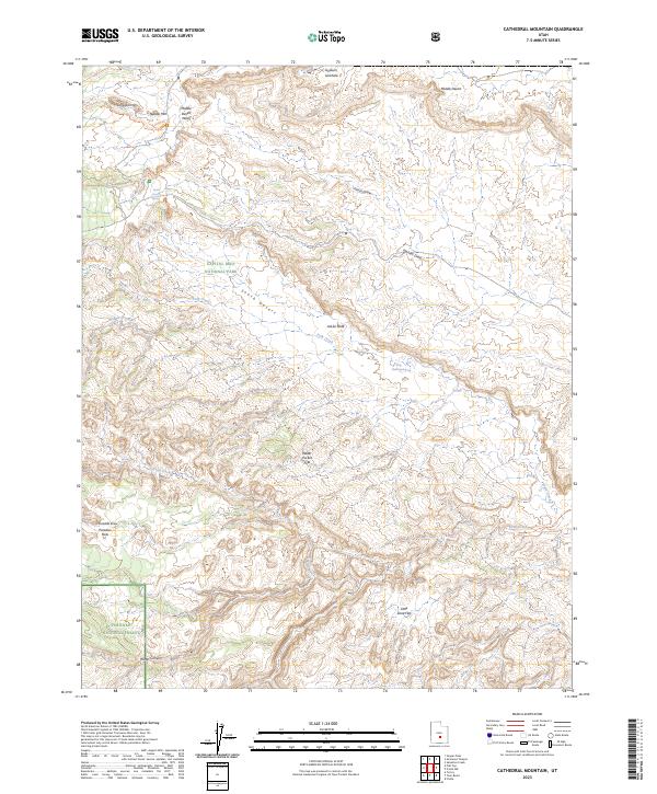
2023 Map of Cathedral Mountain
USGS Topo · Published 2023About this map
Capitol Reef National Park dominates this desert landscape, where the geological uplift of the Water Pocket Fold creates a stark boundary across the terrain. The map details a complex system of drainage and erosion, from the northern Gypsum Sinkhole to the southern reaches of the Fishlake National Forest. Distinctive landmarks like Cathedral Mtn and Needle Mtn rise above the high-desert plains of the Middle Desert and South Desert. These open expanses are punctuated by vital water sources such as South Desert Spring and Ring Water Spring, which served as critical landmarks in an arid environment. The map captures the intricate network of canyons and draws, including Paradise Draw and Water Canyon, illustrating the natural conduits that shaped movement through this part of Wayne County.
Find a feature on this map
22 named features on this map. Tap any name to fly to it.
Don’t see what you’re looking for? This feature index may not catch every label — zoom into the map to look around manually.
Map Details
Editions of this 2023 Cathedral Mountain Map
This is the sole edition of this map. No revisions or reprints were ever made.
Other maps of this area

1885 · Fish Lake
USGS Topo · 1:250,000

1896 · Fish Lake
USGS Topo · 1:250,000

1952 · Notom 2 NW
USGS Topo · 1:24,000

1952 · Notom 2 SE
USGS Topo · 1:24,000

1952 · Notom 2 SW
USGS Topo · 1:24,000

1952 · Notom 2 NE
USGS Topo · 1:24,000

1952 · Notom 1 SW
USGS Topo · 1:24,000

1952 · Torrey
USGS Topo · 1:62,500

1954 · Fruita
USGS Topo · 1:62,500
1954 · Notom 1 NW
USGS Topo · 1:24,000